Newly released satellite images of the Colorado River and Lake Mead in Nevada show the impact the historic drought has had on the region in just one year.
The big picture: The nation’s largest reservoir by volume is at its lowest level since being filled after the Hoover Dam’s completion in the 1930s — prompting the federal government to this week for the first time declare a water shortage for Lake Mead. The Hoover Dam has been operating below its maximum capacity all summer, and it may drop further.
Lake Mead on the Colorado River
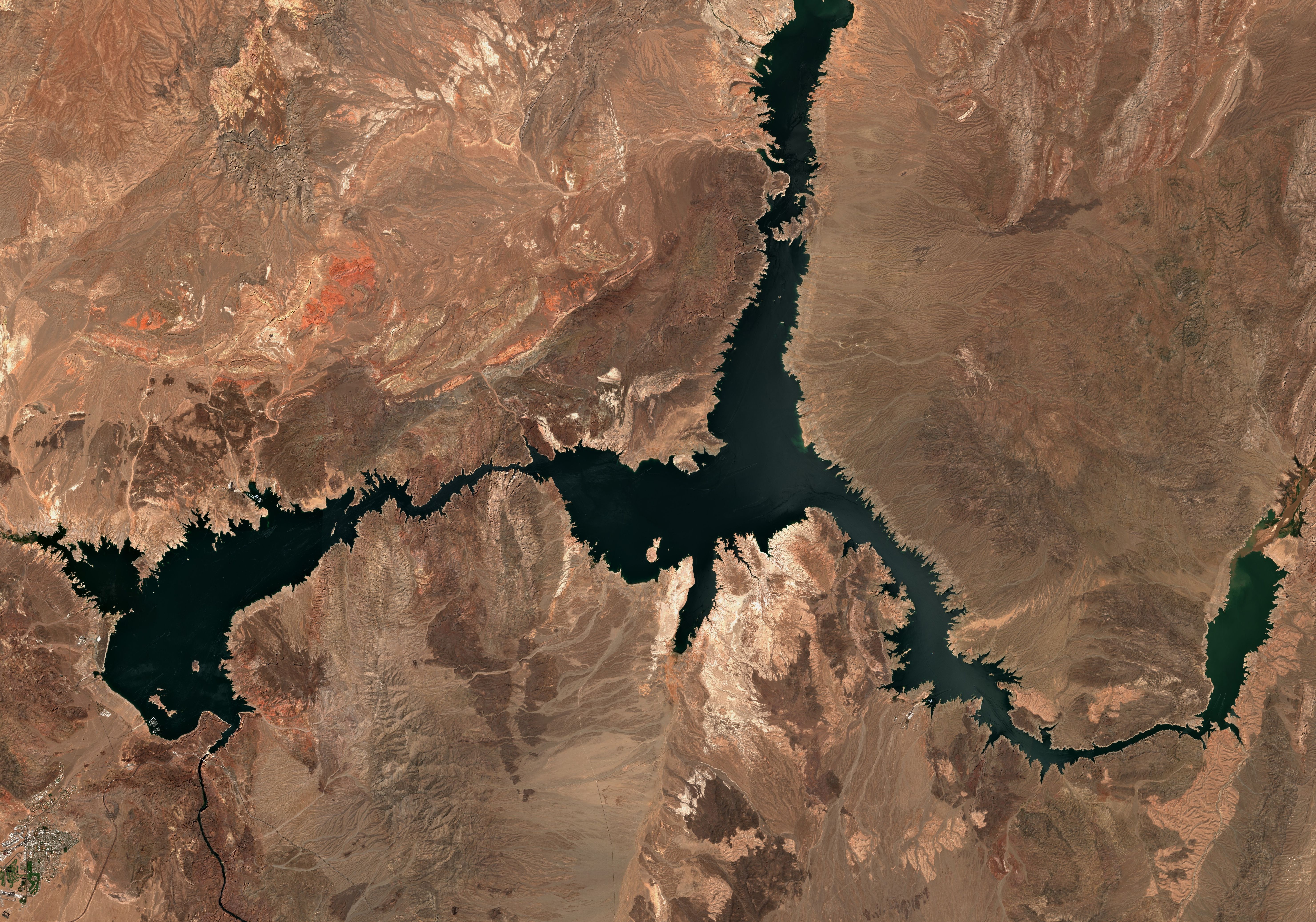
Lake Mead on the Colorado River on Aug. 8 2020. The West is in the grip of the worst drought of this century, while has been hit by the first climate change-caused megadrought seen in the past 1,200 years, per Axios’ Andrew Freedman.Photo: Satellite image ©2021 Maxar Technologies
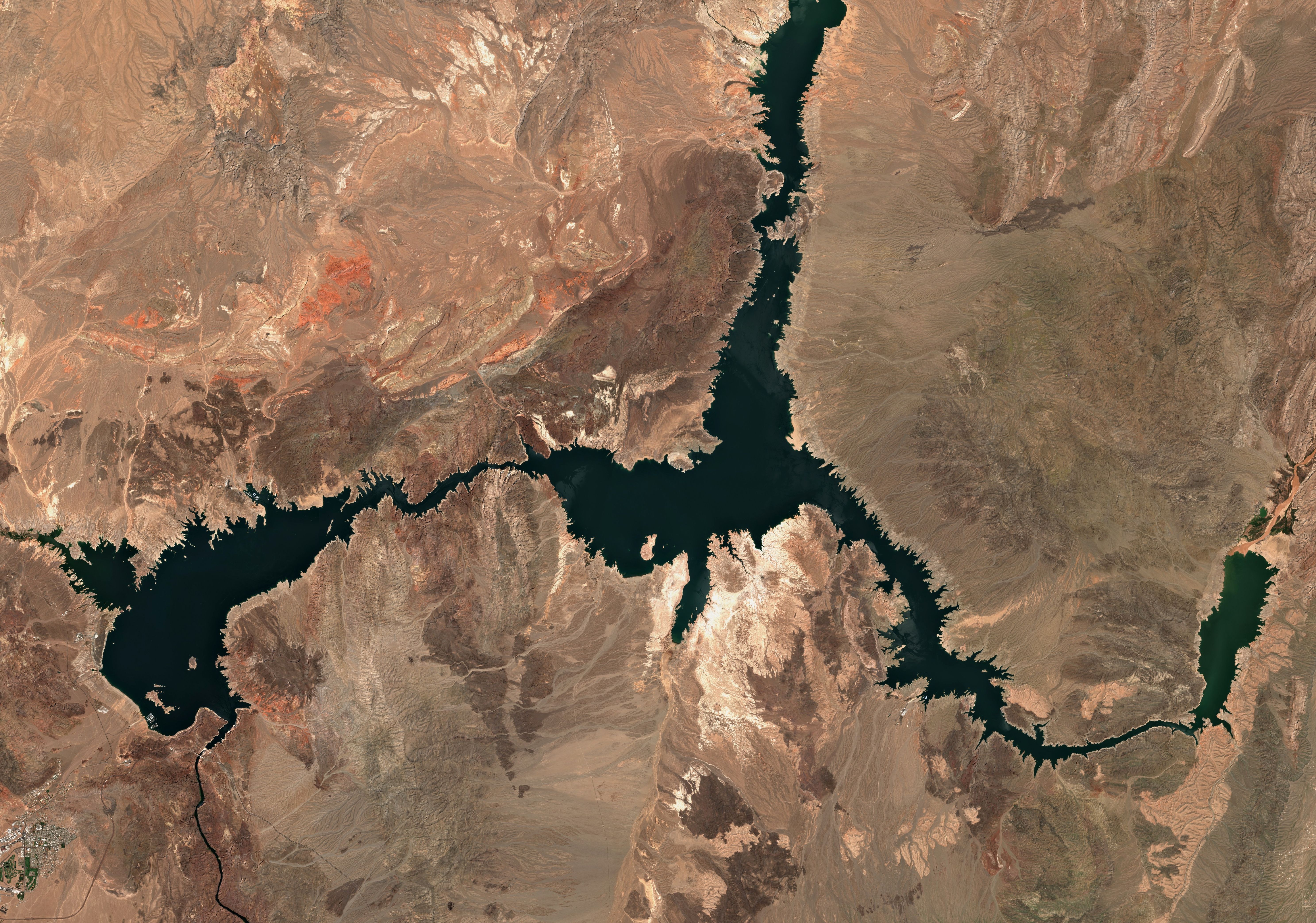
Lake Mead on Aug. 8 this year. Photo: Satellite image ©2021 Maxar Technologies
Southern Lake Mead and the Hoover Dam
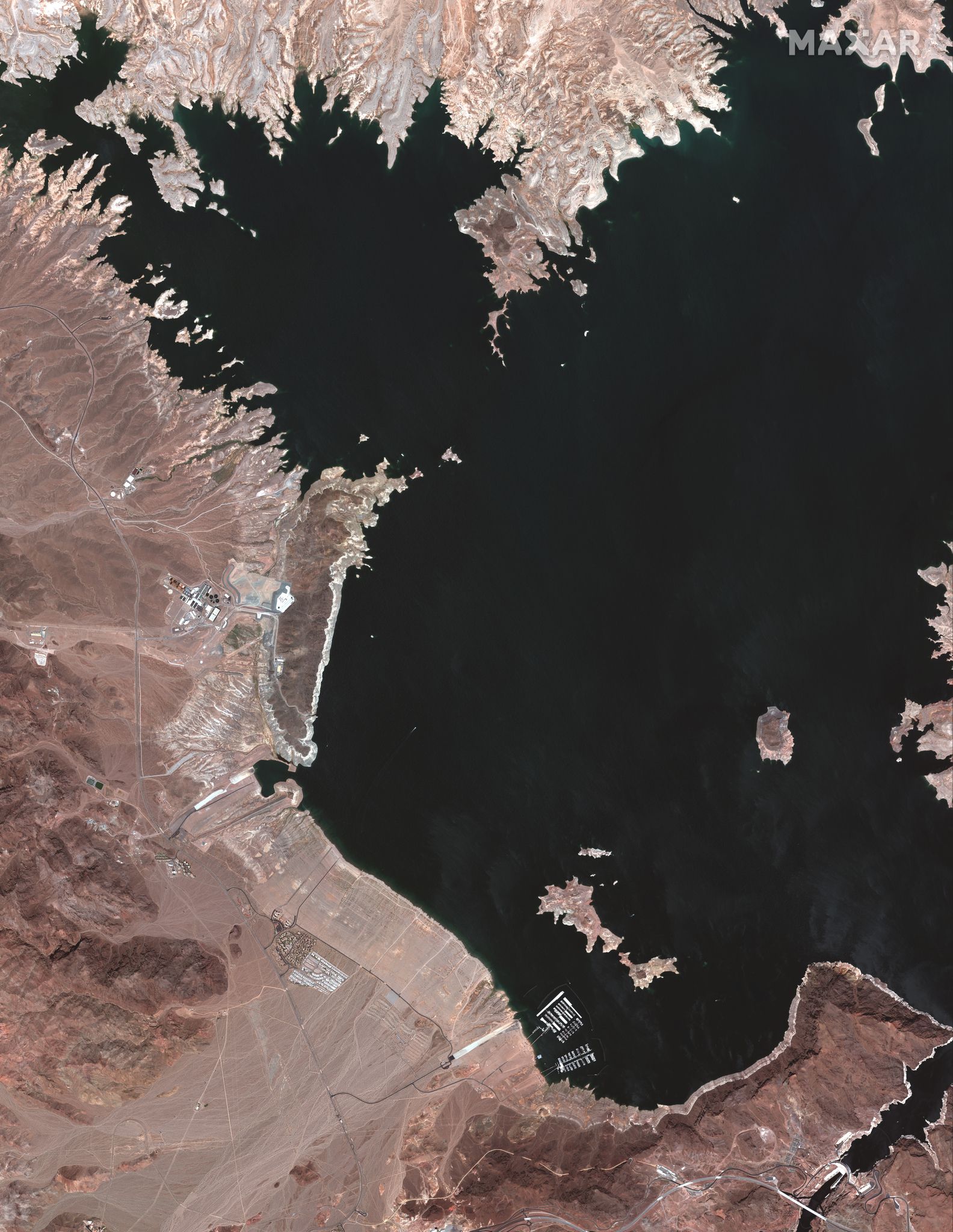
An overview of Southern Lake Mead and the Hoover Dam on May 18, 2020. Photo: Satellite image ©2021 Maxar Technologies
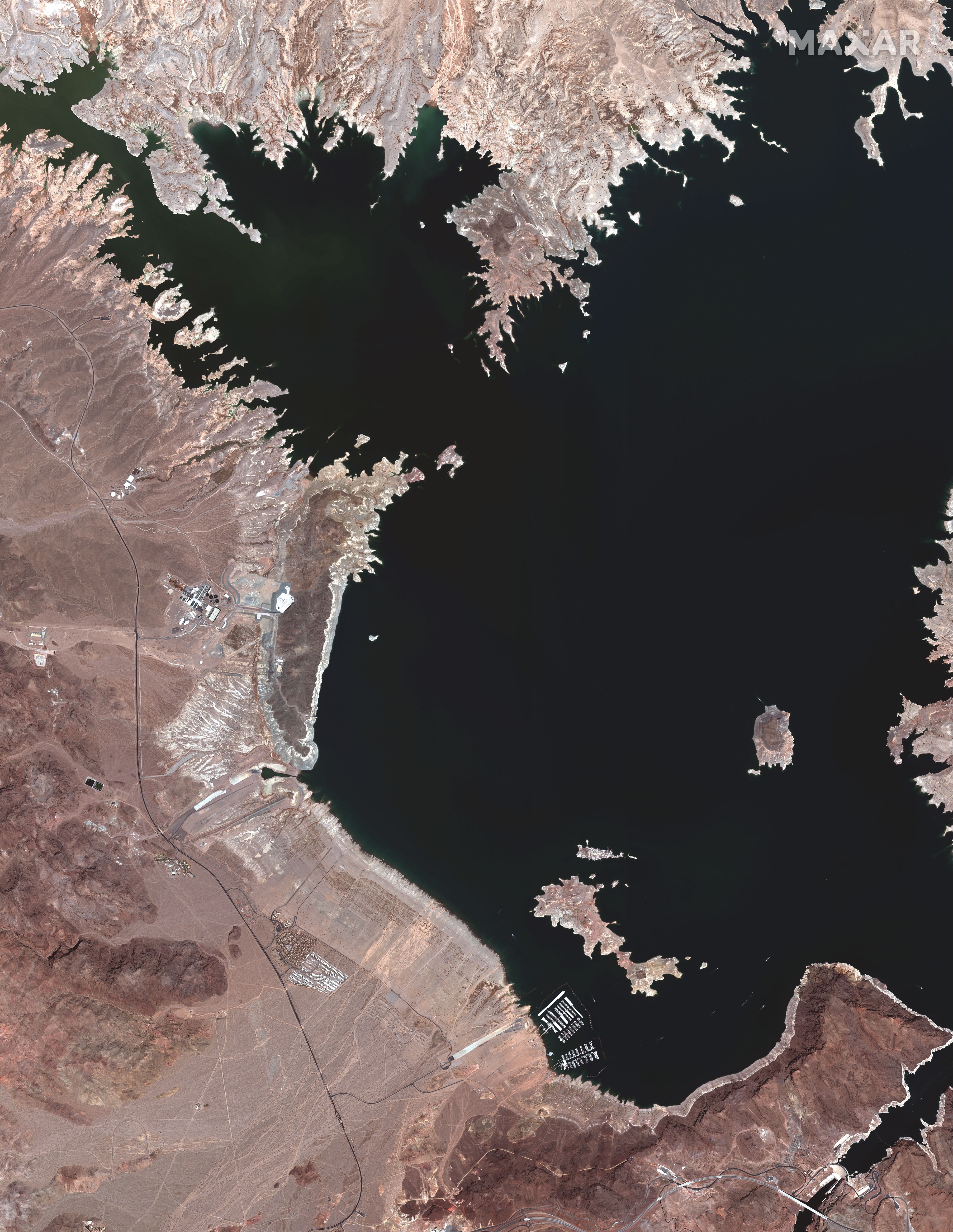
An overview of Southern Lake Mead and Hoover Dam on July 27 this year. Photo: Satellite image ©2021 Maxar Technologies
Hemenway Harbor Boat Launch area
Hemenway Harbor Boat Launch at Lake Mead and Hoover Dam on May 18. Photo: Satellite image ©2021 Maxar Technologies
Hemenway Harbor Boat Launch at Lake Mead and Hoover Dam on July 27. Photo: Satellite image ©2021 Maxar Technologies
The Hoover Dam
The Hoover Dam on May 18. Photo: Satellite image ©2021 Maxar Technologies
The Hoover Dam on July 27. Photo: Satellite image ©2021 Maxar Technologies
Source: https://www.axios.com/satellite-images-extreme-drought-colorado-river-1be12df1-c222-4114-b790-171c3761ac17.html
Droolin’ Dog sniffed out this story and shared it with you.
The Article Was Written/Published By: Rebecca Falconer
! #Headlines, #Axios, #Conservation, #Environment, #HeatWave, #Newsfeed, #ThePlanet, drought, water, #News, #Science
No comments:
Post a Comment