
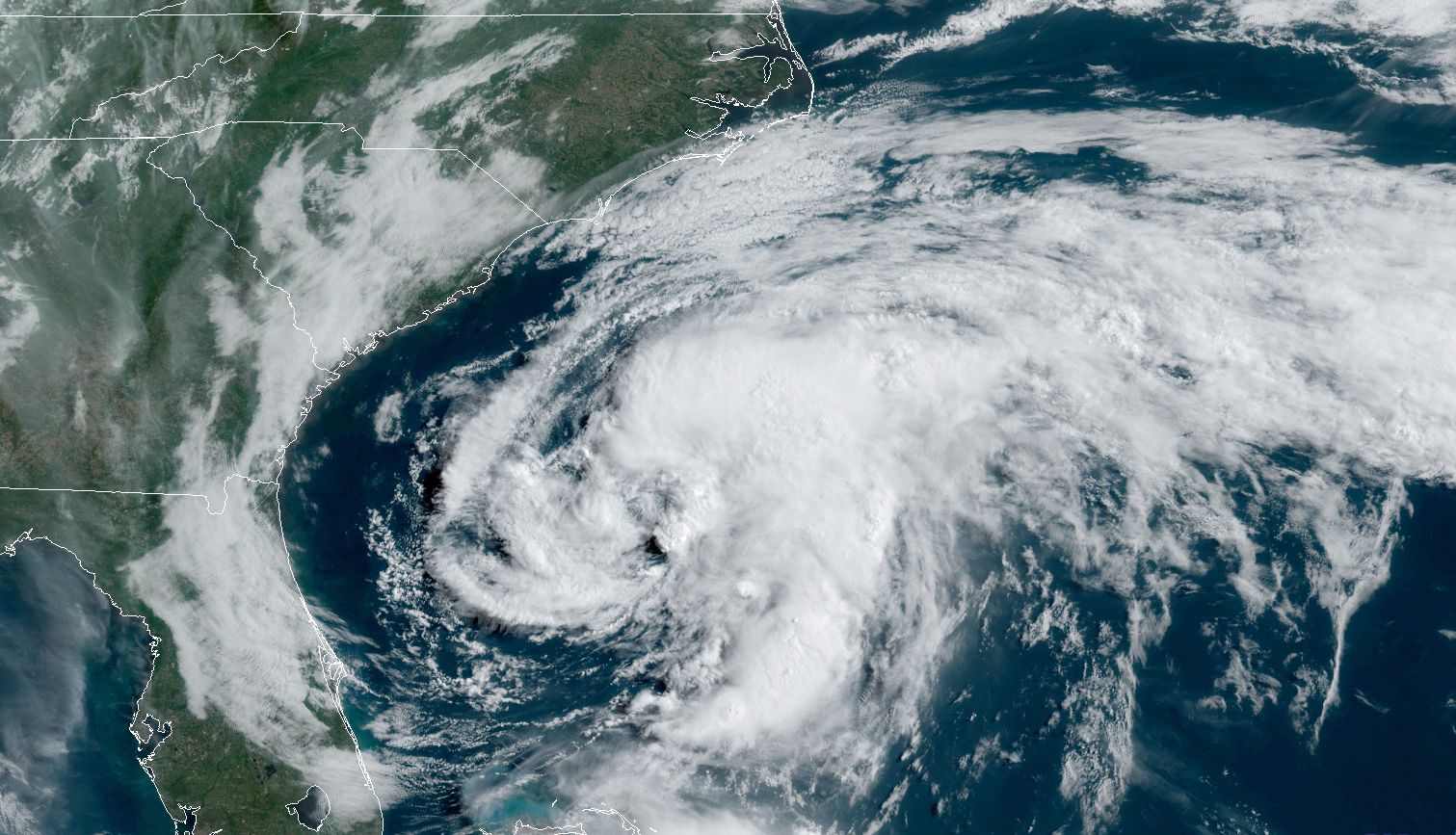
Enlarge / Tropical Storm Arthur formed late Saturday night. (credit: NOAA)
The Atlantic hurricane season’s first named storm formed late Saturday night off the eastern coast of Florida, when its sustained winds reached 40mph.
Named Tropical Storm Arthur, the system should move north-northeast for the next couple of days. Although there is a fair amount of uncertainty about this motion, Arthur should come near, or just over coastal North Carolina, where Tropical Storm Warnings have been raised. After this Arthur is likely to bend due eastward, away from the mainland United States and out to sea.
Because of low wind shear and moderately warm waters, Arthur may remain a tropical storm and even strengthen a little before succumbing to cooler waters later this week. The National Hurricane Center forecasts the system to reach maximum sustained winds of 50mph on Monday.
Read 4 remaining paragraphs | Comments


Source: https://arstechnica.com/?p=1676687
Droolin’ Dog sniffed out this story and shared it with you.
The Article Was Written/Published By: Eric Berger
! #Headlines, #Climate, #ClimateChange, #Florida, #Hurricane, #Storms, #TechNews, #ThePlanet, #Weather, #News, #Newsfeed
No comments:
Post a Comment